Digital Orienteering Map Archive for Gregory Blot
|
Log in
All users
|
Language:
English
Česky
Dansk
Deutsch
Eesti
English
Español
Français
Italiano
Magyar
Norsk
Polski
Português
Русский
Svenska
Türkçe
Український
|
DOMA 3.0.10
Show overview map
Hide overview map
|
KML
|
Back
<< O'Tramontane Etape 3 (15/07/2013)
|
O'Tramontane Etape 5 (18/07/2013) >>
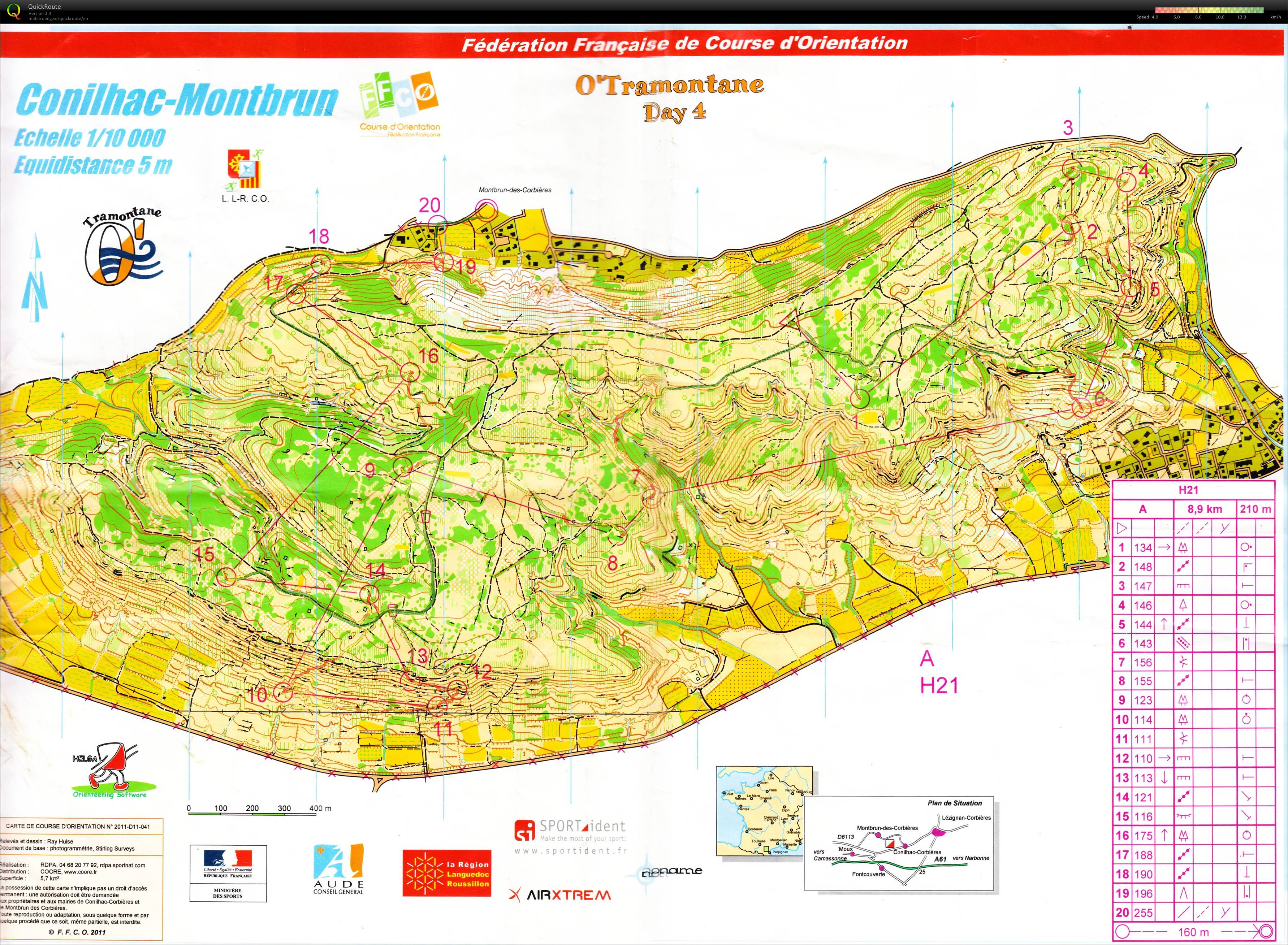
O'Tramontane Etape 4 (17/07/2013)
Category:
Compétitions
Map/area:
Conilhac - Montbrun
Organiser:
CDCO 11
Country:
France
Discipline:
CO
Distance:
12.54 km
Time:
90:58
Average HR:
168
Maximum HR:
181
Une course enfin correcte et propre de bout en bout, sur un terrain peu commun, aidée par des jambes du tonnerre! Seuls petits bémols: hésitations à l'approche de la 6 (ravins non marqués), erreurs d'approche à la 9, quelques passages "piquants" bien ralentissants, et un léger manque de lucidité entre 18-19. Moins de 4 minutes d'erreurs et des bons choix
Show comments
Hide comments
(
0
)
Post new comment
Name:
Email:
Save
 English
 Česky
Česky Dansk
Dansk Deutsch
 Eesti
Eesti Español
 Français
 Italiano
 Magyar
 Norsk
Norsk Polski
 Português
 Русский
 Svenska
 Türkçe
 Український